
A Lesson from a Fisherman: Who Controls Resources? Who Defines Development?
Foodthink Commentary
I. Storm Surge: National Park and Small Island
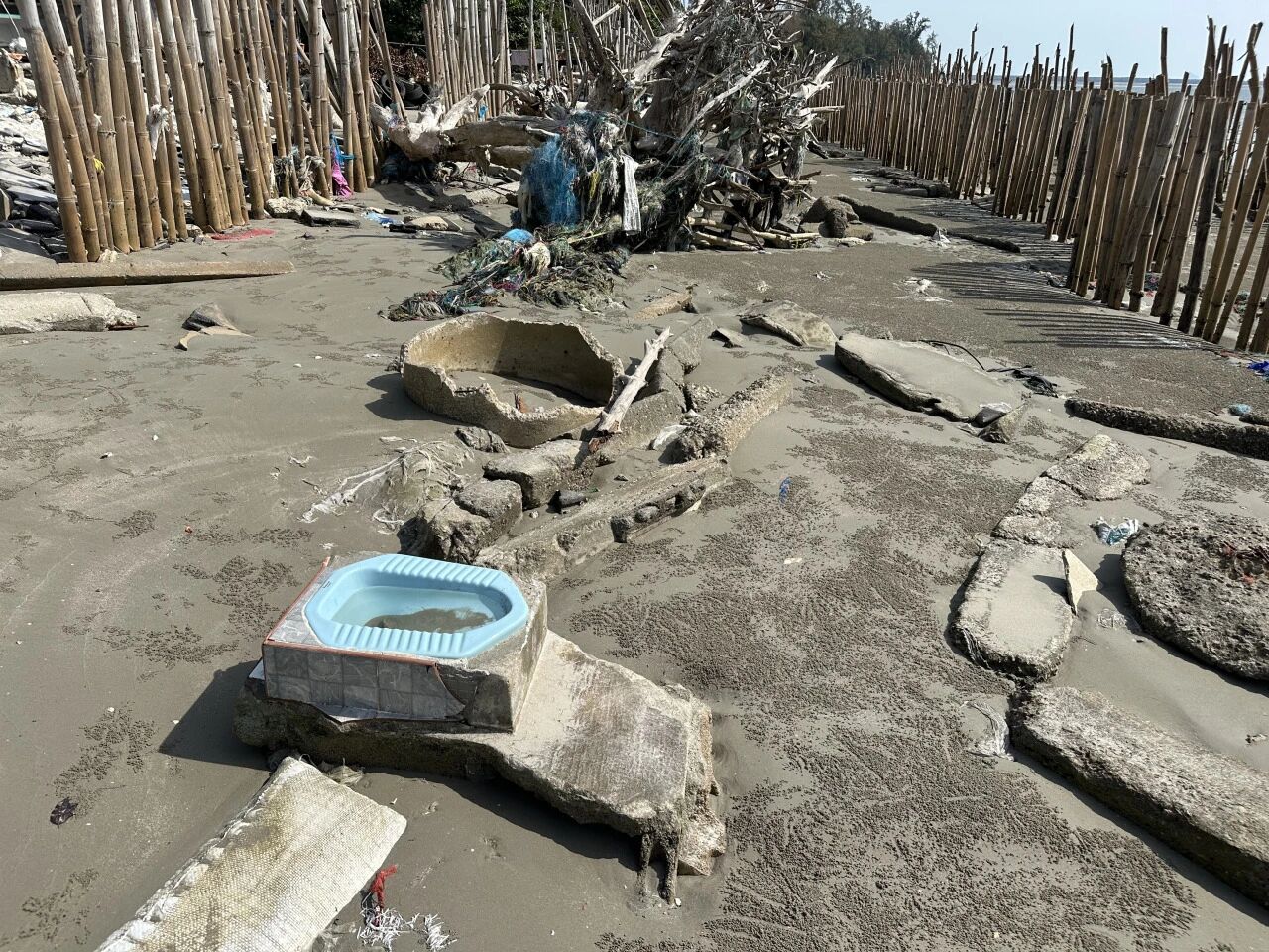
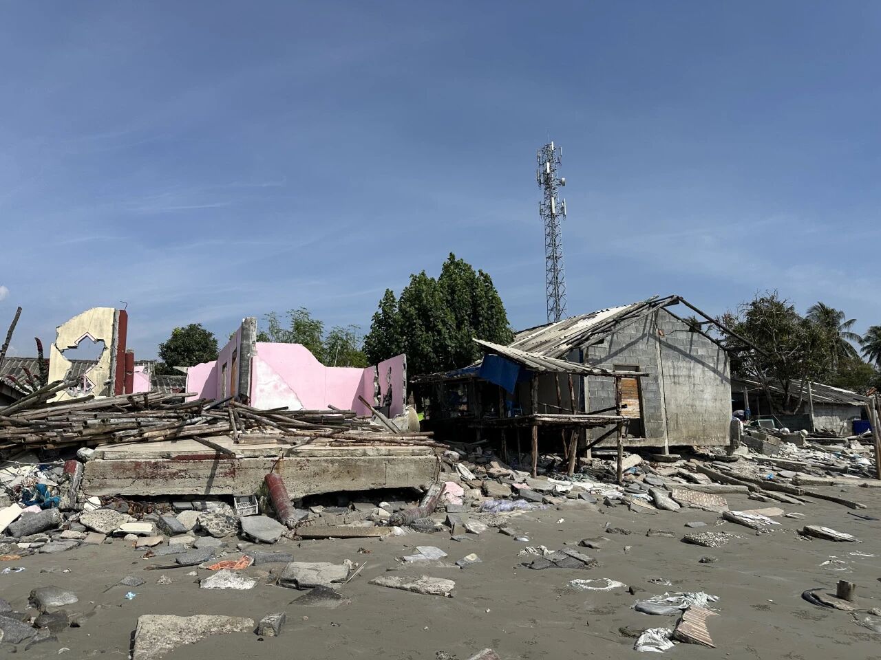
The fishermen in this village are all Muslims, their ancestors having migrated here from Malaysia, and some can still speak Malay today. The 17 households whose homes were destroyed by the storm have nowhere to live and are still staying with relatives.
“There’s nowhere to rebuild homes for them,” says Nok. He is the director of an NGO in Trang Province called the Save Andaman Network (SAN). His full name is Phakphum Vithantirawat, but everyone calls him P’ Nok (in Thai, placing P’ before a name denotes respect for an elder).
The reason is rather absurd: this stretch of coast falls within a national park, and the authorities only permit villagers to rebuild on their original plots. Elsewhere, it is not allowed. Yet, having endured such a disaster, the villagers are understandably shaken and refuse to build houses in such a sensitive, vulnerable zone.
On top of that, the storm caused water levels to rise, severely eroding the coastline and washing away a layer of sand, bringing the fishing village closer to the sea. With climate change, the likelihood of storms of this intensity may well increase. To rebuild here would be to wage a futile battle against nature.
But the villagers had little choice. This is by no means an isolated case—when an area is cordoned off and designated a “national park” in the name of conservation, the indigenous communities who have inhabited it for generations are often deprived of the land, game, timber, and other resources essential to their livelihood. This pattern is being repeated across many nations.
A fundamental question arises: “Who controls the resources? Who holds the power to make the rules?” This has been the most resonant theme of my journey. Indeed, at nearly every stop, the circumstances prompted reflection on this very issue.
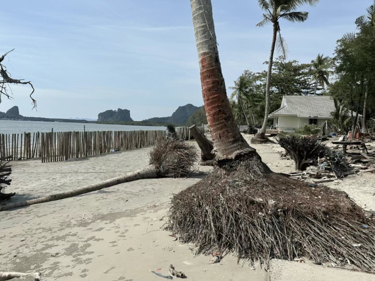
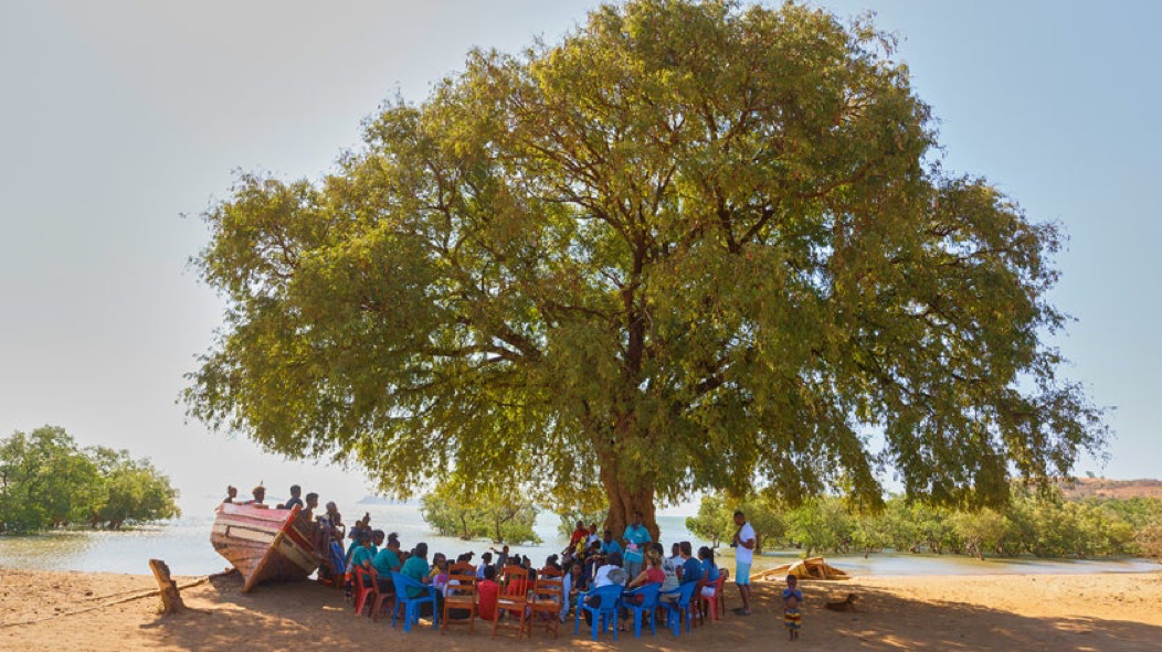
Yet the villagers have refused to give up. We visited this site to see several rows of bamboo poles installed between the ruins and the sea. These poles are designed to dissipate wave energy and trap sand. The government had initially planned to erect a concrete seawall, but the locals argued that a rigid wall would only reflect higher waves back and leave floodwater trapped inland with nowhere to drain. Ultimately, they chose bamboo.
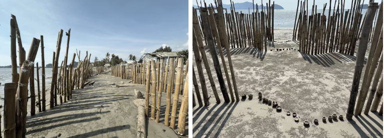
The government dispatched workers to bore holes in the sand using high-pressure water jets, then drove bamboo poles a metre deep. To outsiders like us, the result was a striking sight: rows of bamboo stretching far into the distance across the barren shoreline. The technique may look crude, but it is remarkably effective. In practice, it builds up a sand layer 70 to 80 centimetres high each year, amounting to a grassroots form of land reclamation. In this humble, gradual manner, humanity claims territory from the sea, inch by inch.
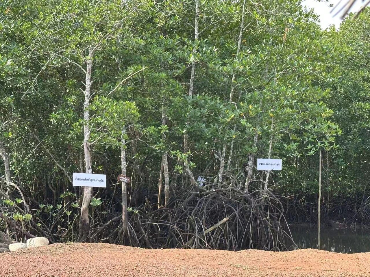
To secure the hard-won sand, villagers also planted red mangrove seedlings at the base of the bamboo poles. These are said to reach maturity in three to four years. The locals prefer planting several seedlings together, believing it allows them to “grow up alongside friends, so they won’t feel lonely.” This practice is scientifically sound: in areas prone to strong winds and waves, planting two or three seedlings in close proximity allows their roots to intertwine, significantly reducing the risk of them being uprooted.

“Look, that’s a newly formed little island!” said the village headman showing us around, pointing to a patch of land barely visible above the water nearby. It used to be nothing more than a shallow sandbar, visible only at low tide. It took just seven years for this once featureless flat to grow into the astonishing little island it is now. (Perhaps that storm washed the sand away and deposited it here, hastening its rise – who knows?) Coconut trees have already taken root, and fishermen can catch crabs in the shallows nearby.
Where seagrass meadows once thrived, rudimentary bamboo barriers are now reclaiming land, and an island has sprung up in the shallows. The transformation of sea into land can happen in just a few short years. In that moment, I felt just how much humanity resembles ants.
II. The Vanishing Seagrass and the Dugong

“Just walk across,” he said.
I was startled to realise the water was so shallow. We rolled our trousers above the knees and stepped in barefoot; the sea came only to our knees. The fine, soft sand beneath our feet felt like walking on wet clay.
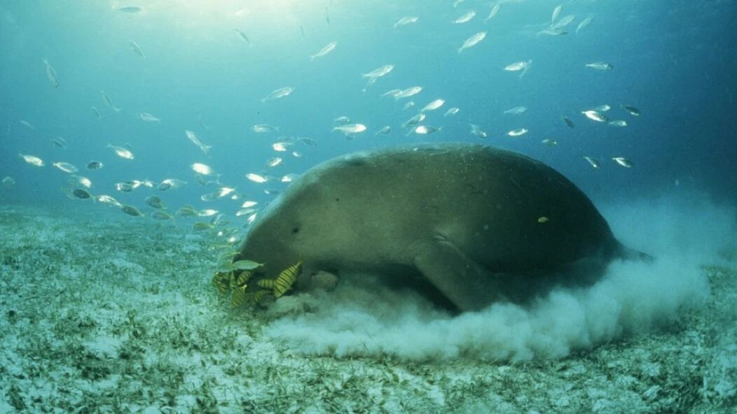
Getting closer, I realised the “floating matter” I had taken for an algal bloom was actually aquatic plants growing on the seabed. It was, in fact, a sandy beach nearly exposed at low tide, covered by only a thin veneer of seawater. The most abundant species was a short-leaved seagrass, a primary food source for dugongs.
Nok pointed to a series of faint trenches in the sand beneath our feet. “These are dugong trails,” he said. Illuminated by the low sun, the tracks were clearly visible. When the tide rises, dugongs glide in here, mouths pressed to the sand, undulating rhythmically as they feed. A single adult dugong can consume 45 kilograms of seagrass in a day.

Once seagrass beds are damaged, dugongs quickly succumb to starvation and death. This is precisely the tragedy unfolding in these waters in recent years.
The root cause lies in the dredging project on the Kantang Channel of the Talu River. Designed to accommodate larger cargo vessels, the project is intended to support the broader development goals of the Indonesia–Malaysia–Thailand Growth Triangle (IMT-GT). However, the excavated silt and rock were dumped into the sea and dispersed outward along the river estuary. Although this area is a protected no-fishing zone and lies some distance from the worksite, it has still been affected. According to Nok, the sediment reaching here has virtually wiped out all the local seagrass beds. Members of SAN have encountered numerous dead dugongs in these waters.
The dredging operations sparked public protests in 2020, forcing the government to temporarily halt the project. They have since commissioned specialists to conduct a new environmental impact assessment, identify a suitable disposal site for the dredged material, and resume channel clearance in a manner that safeguards both the ecosystem and the livelihoods of local fishermen.
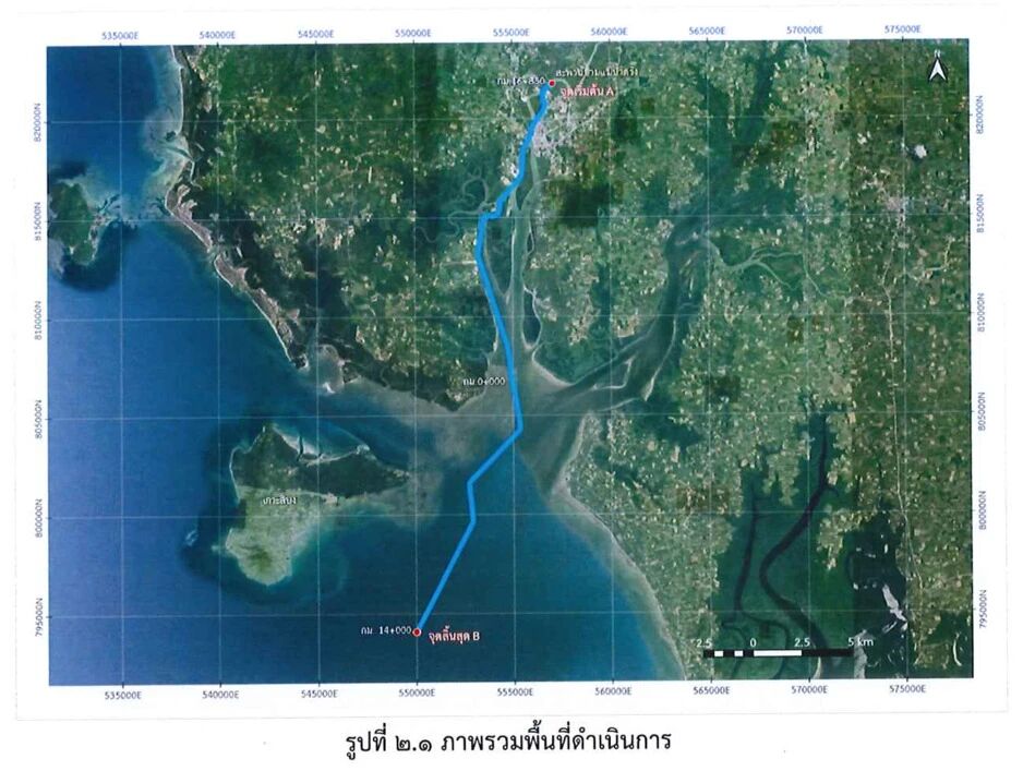
This area once hosted over a thousand hectares of seagrass beds, sustaining Thailand’s largest dugong population. But as Nok explains, the contractors offered only one justification for this catastrophic outcome: “When work began, we assumed the impact would be confined to the river channel.” It was not until 2024, four years after construction halted, that the seagrass began to regenerate here—the very patch lying beneath our feet.
According to a report by the US non-profit environmental outlet Mongabay, Thailand’s dugong population numbered around 273 in 2022, with 90 per cent residing in the Andaman Sea. Today, however, a third of that population may already be lost. In 2024, at least 40 per cent of dugong deaths were attributed to starvation following the widespread collapse of seagrass meadows.
A government scientist interviewed by Mongabay noted that most of Trang’s dugongs had either perished or were dispersing along the coastline “struggling to survive,” ranging northwards to Krabi, Phang Nga and Phuket, and even into Myanmar. To the south, at least three dugong carcasses were discovered near Langkawi in Malaysia. The scientist estimates that fewer than ten dugongs may now remain in Trang province.
In this light, being able to witness the recovering seagrass beds and the grazing trails left by dugongs that day felt like a rare glimpse of survival against the odds. Yet Nok worries that the displaced animals face an uphill battle. They must adapt to unfamiliar waters, and are vulnerable to injuries from collisions with unaccustomed fishing vessels. “In Trang, fishermen know how to throttle back to steer clear of dugongs; elsewhere, that awareness simply isn’t there.” He added, “Here, we protect them. Out there, our hands are tied.”
The distant waters the dugongs swim to do not necessarily hold food. As Mongabay reported earlier, there are virtually no viable seagrass beds around Phuket. Government officials have even tried supplementing the migrating dugongs’ diet with kale and cabbage—the kind of food typically fed to rescued dugongs in aquariums.
Fishermen can campaign and mourn over their own ruined homes, but when it comes to speaking up for dugongs, seagrass, and corals, only environmental NGOs such as SAN can step in.
Libong Island is also home to a variety of long-leaf seagrass that serves as food for sea turtles. Yet, as Nok explained, this seagrass takes two years to mature enough to reproduce. If turtles eat it during that window, it struggles to spread and form dense meadows. “So there’s a built-in tension between conserving sea turtles and conserving seagrass,” they said, looking quite troubled, even though one of the very purposes of seagrass conservation is to provide food for turtles.
They approached it almost like an experiment, using bamboo poles and fishing nets to enclose a patch of beach just a few square metres across to plant the long-leaf seagrass, but the results were poor. By the time we visited, the area was almost completely bare, with only a handful of sporadic long-leaf seagrass shoots poking through.

III. Crab Bank
Since the 1990s, rising global demand for crab meat, coupled with unsustainable methods such as trawling, drove Thailand’s blue swimming crab catch to a peak in 1998 (46,678 tonnes), far exceeding the maximum sustainable yield. To safeguard fishery resources, the Thai government introduced a series of conservation policies, while local communities also took action. The crab bank is one such grassroots initiative.
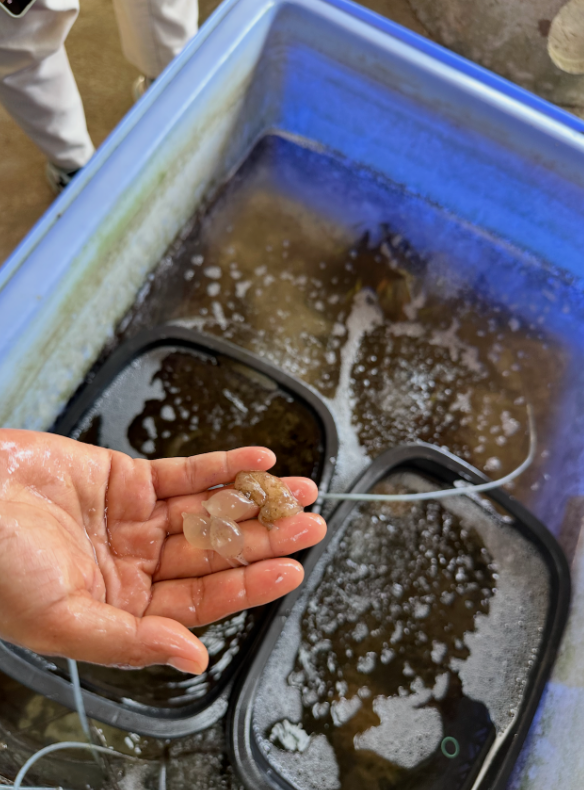
The facility we visited is housed in the community conservation centre and consists of a simple wooden shed. A row of large blue plastic barrels sits on the ground, while several glass tanks rest on tables, connected by dense tangles of plastic tubing to aerate the water. The village head casually lifted a female crab from a barrel; its underside was covered with a mass of bright orange eggs. Tens of thousands of eggs cling to the mother’s abdomen via a layer of mucus. The orange colour indicates they are still developing. The village head explained that once the eggs turn grey, they are nearing hatching, and the crabs must be released back into the sea within five days.
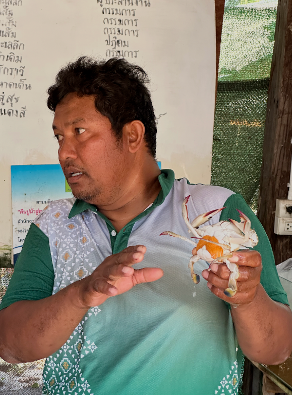
These eggs will hatch in seawater into planktonic larvae, with a single batch numbering anywhere from several hundred thousand to over a million. The village head believes the crab bank has been effective in aiding population recovery. He noted that previously, blue swimming crabs could only be caught for six months of the year, but now they are available year-round, serving as a crucial source of income.
Local fishermen have made it a practice to bring other breeding marine creatures here for temporary care, not just blue swimming crabs. We also saw squid eggs, resembling a cluster of clear grapes. They had been spotted tangled in a fishing net during a haul and brought back.
As reported by Mongabay, the data does show that blue swimmer crab populations have indeed increased since the Crab Bank and “other measures” were put in place. In 2017, Thailand’s Department of Fisheries, WWF, and several private-sector partners launched the Fisheries Improvement Project. Promoted measures included the Crab Bank, seasonal bans on harvesting egg-bearing crabs, and restrictions on trawling and specific types of fishing gear, such as crab pots with a mesh size smaller than 6.4 cm.
Yet, stock enhancement alone is not enough. Amonsak Sawusdee, a marine biologist who has studied blue swimmer crabs for decades, stressed the importance of implementing and enforcing appropriate regulations on fishing gear, alongside the establishment of protected areas for spawning and juvenile crabs.
Within the very same waters, industrial projects that decimate vast stretches of seagrass beds stand in stark, almost absurd contrast to the fishermen’s Sisyphean efforts with the Crab Bank. Yet, it is precisely this grassroots initiative by the fishing community, partnered with NGOs, that has pushed back against destructive industrial developments and overfishing, while safeguarding native species.
How can a conservation model built on local knowledge and co-managed by coastal communities become the norm? Locally Managed Marine Areas (LMMAs) offer a viable pathway—what we refer to as a “community conservation area” model, jointly overseen by government and local stakeholders.
IV.LMMA: Community-Led Ocean Management
The LMMA approach emphasises the coexistence of conservation and livelihoods, as this is the only way for local communities to sustain themselves and remain in place. How fishing communities are forging their own livelihood models will be explored in the next report. In this piece, we first examine how such a multi-stakeholder framework—bringing together government bodies, NGOs, and civil associations—is implemented on the ground.
First, it should be noted that, as in China, marine and coastal resources in Thailand—such as mangroves—are state assets administered by the Department of Marine and Coastal Resources (DMCR). Community conservation areas also fall under the DMCR’s remit. Conversely, areas designated as marine national parks carry a higher protection status and are managed directly by the Department of National Parks, Wildlife and Plant Conservation.
During our visit to the well-known Mu Ko Phetra National Park in Trang Province, however, we found two community conservation areas embedded within its boundaries. An official from the local park authority explained that for its first 42 years, the park operated under a strictly exclusionary management model. In biodiversity conservation, “protected areas” are typically designated zones focused on species preservation, with national parks being the prime example. Yet, this approach has frequently led to the marginalisation of local and indigenous communities in many regions.
Park managers eventually recognised, however, that this was unworkable and that locals needed to be permitted to earn a living from the park, provided it was done in a sustainable manner.
As we spoke, we stood beneath a blue sign erected by the sea the previous year. It detailed the management rules for the community conservation areas, delineating their boundaries, prohibited activities (such as the use of illegal fishing gear), and applicable penalties. The map on the sign shows the entire zone as part of the national park, with yellow and orange sections marking the community conservation areas allocated to two separate villages.
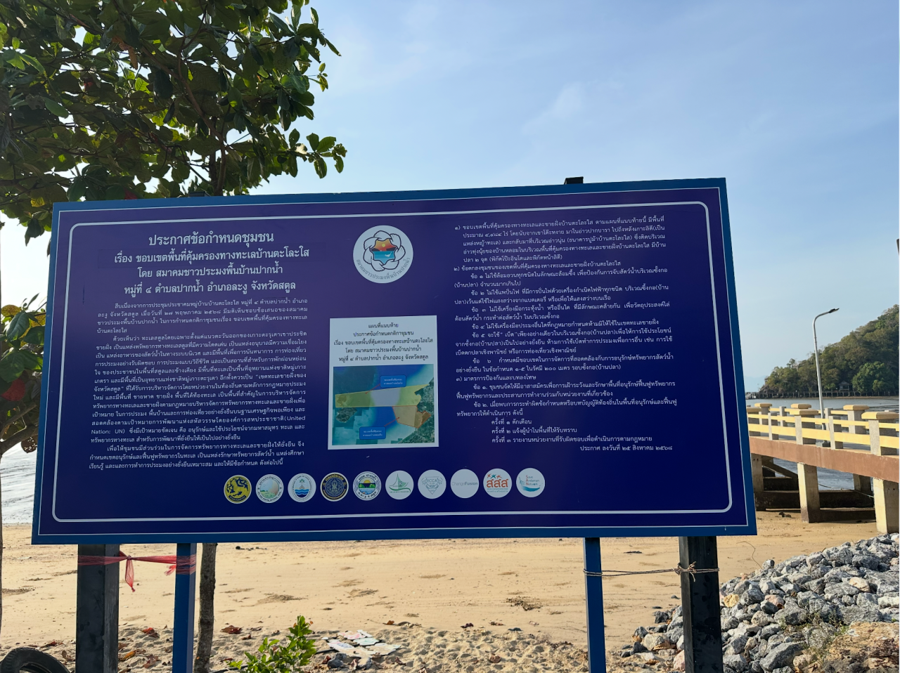
Fishing is strictly restricted across the entire national park; should fishermen wish to harvest, they are confined to using only the most traditional gear. Yet within the two community-managed protected areas shaded yellow and orange on the map, locals are permitted to undertake greater fishing and foraging activities. These privileges are paired with specific duties: species monitoring, patrolling, and the construction of fish habitats. At first glance, these two community sites might seem to be “taking resources from the national park’s jaws”, but in return, they require fishermen to demonstrate that alongside their fishing, they are actively restoring the marine ecosystem.
This raises an interesting point: these community-managed sites, known as LMMAs and overseen by DMCR, actually fall within the boundaries of the national park. They answer to different government bodies, and in terms of legal standing, national park legislation takes precedence over the management framework for community sites. In essence, LMMAs operate as a governance model woven into the statutory framework of the national park. Reaching this stage has been made possible only through years of constructive engagement and mutual trust among various government departments, fishermen’s associations, and NGOs.
In practice, LMMAs are indeed established through negotiation between local communities and the government. Only areas meeting specific criteria can apply for community status: the community must hold traditional or established usage rights, be represented by a clear community organisation (such as the fishermen’s association we encountered on this visit), and have reached internal consensus to draft a set of management rules.
When it comes to “drafting management rules”, the role of NGOs is often indispensable. Within the community, they focus on raising awareness and building capacity—teaching fishermen how to monitor species, map local areas, understand procedures for community meetings, and learn about their legal rights. Externally, they act primarily as intermediaries, “translating” the community’s claims into a language that facilitates dialogue with government bodies and other stakeholders. This is particularly crucial when navigating policy advocacy or legislative proposals, where precise legal terminology is required.
This bridging role is clearly visible in the way our visit was arranged. Our opportunity to meet and exchange a few words with the national park’s management leadership was made possible by an invitation from the Thai Sea Watch Association (known locally as “Sea Watch”). Whether we were in Sea Watch’s offices, touring the fish sanctuaries by boat, or sitting on the floor in the community chatting informally with villagers, the attendees came from a wide range of backgrounds. We had community representatives, women’s delegates, local council members, and government officials—often from multiple agencies at once, such as DMCR and the National Park Department… Even when the conversations required sentence-by-sentence consecutive interpretation and stretched over half a day, they remained patient and engaged throughout.
Fishermen are required to draft their own local rules and regulations. In Sa Duan, the fishermen participating in LMMAs that collaborate with Sea Watch were also asked to name their respective protected zones. This highly ceremonial act of “naming” is designed to foster a tangible sense of community ownership.
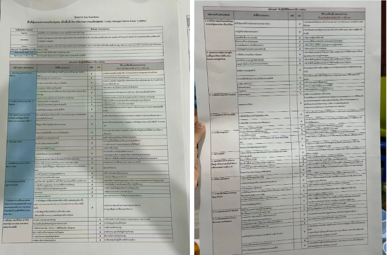
The management rules for LMMAs must also be formally recognised by the various government departments involved in their oversight. Tab, the director of Sea Watch, showed us a memorandum of understanding signed by the local community, the municipal government, and NGOs. Spread across two large sheets of paper, the densely packed Thai text outlined management protocols that had been negotiated line by line and formally endorsed by all parties. The clauses pertaining solely to the community spanned 19 distinct categories, including stipulations such as: no member may act alone; cooperation with partners is mandatory, and these partners may be government bodies, NGOs, or neighbouring villagers.
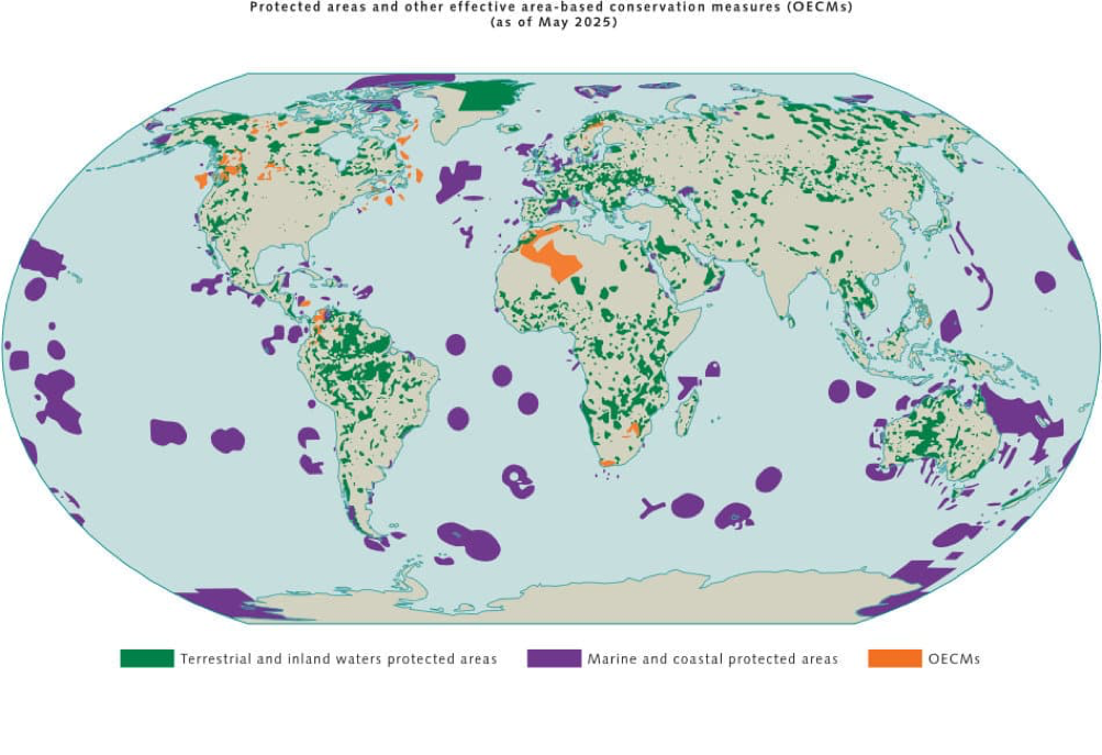
Language shapes thought, and coining new concepts is a well-worn tactic for NGOs engaged in policy advocacy. Consider, for example, the concept of OECM—Other Effective Area-based Conservation Measures—which was developed to advance global conservation efforts. While many LMMAs could qualify as OECMs, Tab notes that they favour the LMMA framework.
OECM designates areas outside formally protected zones where governance consistently delivers in-situ biodiversity conservation outcomes, such as urban green spaces or nature-friendly farmland. In 2018, OECM was formally defined as a statistical reporting tool under the Convention on Biological Diversity. Nations are required to report on OECMs to track progress against global conservation targets.
Whether referring to statutory protected areas or OECMs, these frameworks were propelled onto the agenda of global environmental governance by international bodies—a decidedly ‘top-down’ evolution. Fuelled by international negotiations, OECM is rapidly becoming standard parlance among governments and international organisations. Numerous community-managed conservation areas could be designated as OECMs. While they lack the direct funding streams available to formal protected areas, the OECM designation carries prestige that eases access to external support, such as international partnerships and carbon credit trading projects.
Yet NGOs and local fishers favour the more grassroots LMMA concept, which places greater emphasis on community-led management. Tab’s casual dismissal of OECM highlighted a fascinating shift: grassroots NGOs appear increasingly unmoved by the lofty, haloed terminology of international environmental governance frameworks, preferring instead approaches that secure autonomy and deliver tangible benefits.
V. Rejecting Carbon Sink Enclosure
The roots of this opposition lie in the past: for 21 years, a company occupied this mangrove forest under the guise of a charcoal concession. During that time, villagers needed the company’s approval to harvest timber—a permission that was virtually impossible to obtain, forcing them to cut wood in secret. Over those years, they noticed it was growing increasingly difficult to find food in and around the mangroves. They regard crabs and shellfish as indicator species for ecosystem health—and it is not just these two groups that are declining; some seafood has vanished altogether.
The villagers attribute this directly to the company’s logging of the mangroves. The mud crab offers a stark illustration. These crabs burrow into the mud to live; without the mangrove canopy to provide shade, the sun bakes the mud to scalding temperatures, making survival impossible for the crabs. Put simply, without the mangroves, wildlife loses its habitat, and what was once a vibrant, life-giving shoreline devolves into a barren wasteland.

Consequently, once the concession expired, villagers who had recognised the problem began planting trees on their own initiative. Representatives from five villages formed a mangrove conservation group and submitted an application to the DMCR to designate the site as a community conservation area.
The application was approved in 2024. They were successfully granted a ‘community forest’ designation, which confers a ten-year mandate to manage the mangroves. This provides the community with a legal framework to secure their rights to utilise local resources.

A 2025 report by Thailand’s Foundation for Knowledge Promotion revealed that, against the backdrop of the climate crisis, the Thai government has been heavily promoting voluntary emission reduction schemes. These allow corporations to offset their greenhouse gas emissions by purchasing carbon credits funded through mangrove restoration. However, the grassroots implementation of the scheme has sparked serious inequities. For instance, in existing projects, profit distribution sees corporations taking 70%, communities receiving just 20%, and the DMCR taking 10%. Yet neither corporations nor the government have ever transparently explained to the communities the rationale behind these proportions.
Similarly, the DMCR and companies often bypass the wider villagers, going straight to village heads or specific representatives to sign agreements. Villagers have even been coerced into signing agreements under pressure from government officials, without fully understanding the contract terms. This top-down, opaque approach has also sown distrust and division within the communities.
In an interview with HaRDstories, Tab expressed the view that mangrove carbon sink projects fail to genuinely address global warming. “The UN’s principle is that those who emit must take responsibility for remediation, but that has been twisted into the idea of giving us a carbon market,” he said. “Addressing global warming means reducing emissions, not using money to grab things that never belonged to them in the first place.”
Today, with established community protected areas, residents feel more empowered to say no to such land-grabbing projects.
Preview of the Next Article
This is the second of three field notes from Foodthink’s visits to small-scale fishing communities in southern Thailand. The first article, Thirty Years of Joint Ocean Protection: Unity Brings the Catch | A Visit to Southern Thailand’s Small-Scale Fishing Communities, explored how small-scale fishermen in Chumphon Province joined forces to drive out commercial trawlers, and how local fisher associations further organised into a national alliance to actively participate in legislation and policy advocacy. To learn more about how conservation and development coexist in local fishing communities, stay tuned for the third and final article.

All images in this article are credited to the author unless otherwise stated
Editor: Pei Dan