
A Lesson the Fishers Taught Me: Who Controls the Resources? Who Defines Development?
Foodthink Says
I. Storm Surge: The National Park and the Small Island
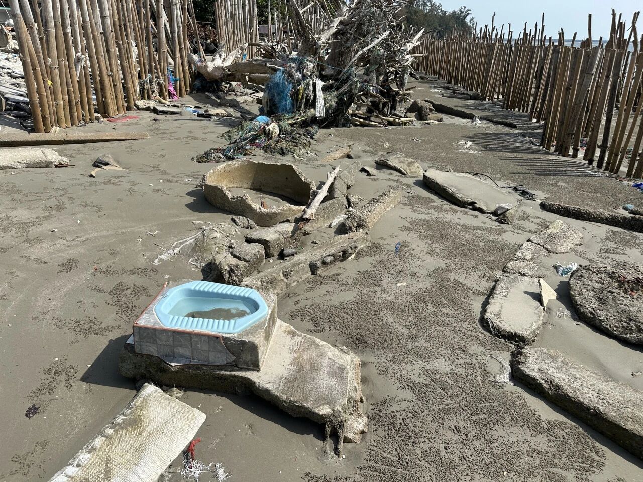
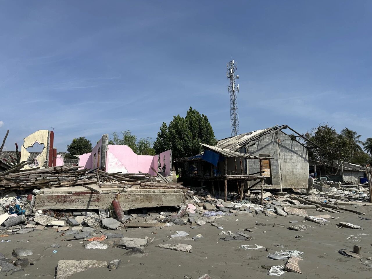
The villagers here are all Muslim, their ancestors having migrated from Malaysia; some can still speak Malay. The seventeen families whose homes were destroyed have nowhere to live and remain lodged with relatives to this day.
“There is simply nowhere to rebuild these people’s homes,” said Nok. He heads Save Andaman Network (SAN), a local NGO in Trang Province, and his full name is Phakphum Vithantirawat. Everyone calls him P’ Nok – in Thai, placing “P'” before a name is a mark of respect for an elder.
The reason is rather absurd: this stretch of coast falls within a national park, and the authorities only permit villagers to rebuild on the original site. Anywhere else – no. And yet, after such a catastrophe, the villagers are too shaken to build again in this fragile, vulnerable zone.
Moreover, the storm sent tidal levels surging, severely eroding the coastline, stripping away a whole layer of sand, and bringing the fishing village closer to the sea. As the climate changes, storms of this ferocity may well become more frequent still. To keep building here would be to take on the heavens – and oh, the boundless joy of it!
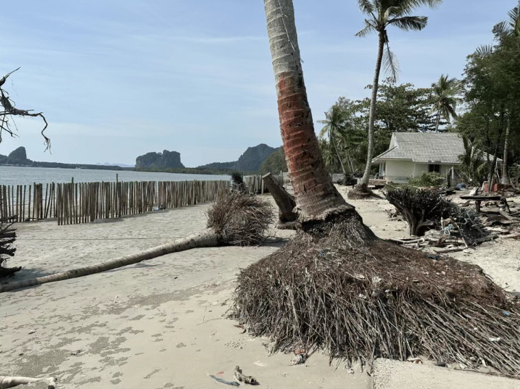
But the villagers have no choice. This is no isolated case – once a tract of land is designated a “National Park” in the name of conservation, the indigenous communities who have lived there for generations suddenly find themselves stripped of the land, game, timber and other resources they depend on for survival. This is a script that plays out in many countries.
The core question here is: “Who owns the resources? Who has the power to set the rules?” That is the thing I found most striking about this trip. Almost everywhere we went, nearly every issue prompted exactly that question.
Yet the villagers have not given up. We came here to see a few rows of bamboo poles standing between the ruins and the sea. These poles reduce the energy of incoming waves and also trap sand. The government had originally wanted to build a concrete wall as a breakwater, but the locals felt a concrete wall would only send the waves rebounding higher and trap water inside, with nowhere to drain. So they ultimately chose bamboo.
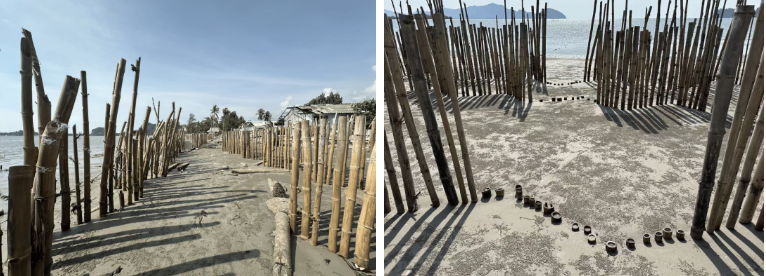
The government sent workers to drive holes into the sand with high-pressure water jets and push the bamboo poles one metre into the ground – and so produced, in our outsider’s eyes, a spectacle: rows upon rows of bamboo spreading across the barren beach into the distance. The method looks crude, but it works. Practice has shown it can trap seventy to eighty centimetres of sand a year – a primitive form of reclaiming land from the sea. Thus, in this small and slow way, human beings beg the sea for land, grain by grain.
To anchor the hard-won sand, the villagers also planted mangrove seedlings at the base of the poles, which they say can grow to full size in three to four years. They like to plant several together, because that way the mangrove seedlings “grow up with friends and won’t feel lonely.” There is real science behind this: in areas exposed to wind and waves, two or three seedlings planted close together will interlock as they grow, reducing the risk of toppling.
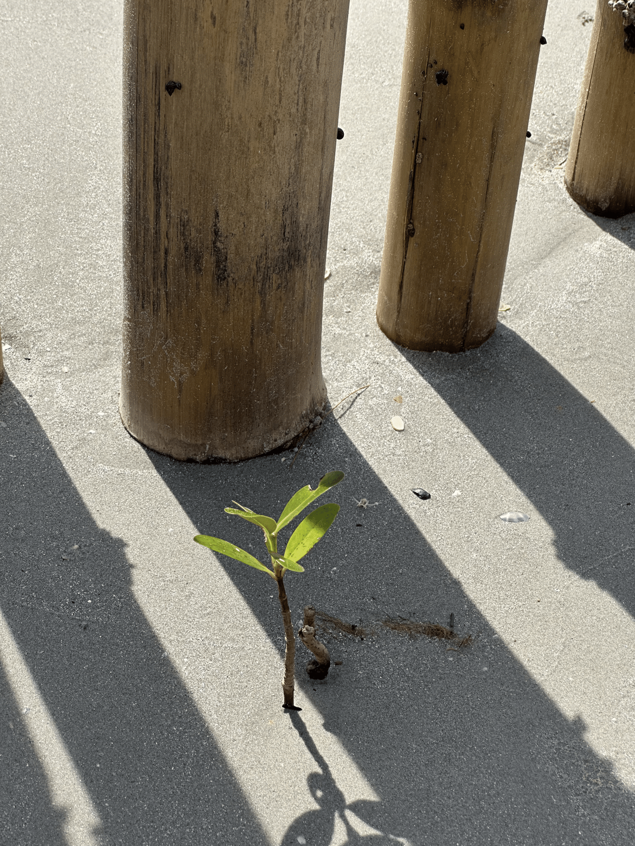
The old seagrass beds are now being turned into land by bamboo and ingenuity, while out in the shallows an island has risen. What was sea becomes farmland – and it can all happen in just a few short years. In that moment, I felt that human beings are very much like ants.
II. The Vanishing Seagrass and the Dugong

“Just walk over there,” he said.
I was startled to find the water was this shallow. We rolled our trousers up above our knees and waded ashore barefoot. The sea barely reached our knees. The sand beneath our feet was fine and soft, as though we were treading on soft mud.
Only when we drew closer did I realise that what I had taken for a sort of algal bloom – those “floating objects” – was actually seagrass growing on the sandy floor. What we were standing on was, in fact, a beach all but bare at low tide, with only a thin film of seawater over the seagrass. The most abundant kind was a short-leaved seagrass – the Dugong’s food.
Nok pointed at the shallow grooves running across the sand beneath our feet. “These are Dugong traces,” he said. In the slanting afternoon sun, the traces were unmistakably clear. When the tide rises, the Dugongs swim into this water, pressing their mouths to the sand, nudging and gouging as they feast. A single adult Dugong devours forty-five kilograms of seagrass a day.

Once a seagrass bed is destroyed, Dugongs slip all too easily into starvation and death. This is precisely the tragedy unfolding in these waters in recent years.
The cause lies in the dredging of the Kantang Channel on the Trang River. The dredging was carried out to accommodate larger cargo vessels and, in a broader regional context, to serve the development plans of the Indonesia–Malaysia–Thailand Growth Triangle (IMT-GT). But the excavated sediment and rock were dumped into the sea and drifted outwards from the river mouth. Although this area is a no-fishing protected zone and sits some distance from the construction site, it has not escaped the fallout. The sediment spread here and, according to Nok, wiped out virtually every seagrass bed. Members of SAN have seen a good number of dead Dugongs in this area.
The dredging operations triggered public protests in 2020. The government was left with no choice but to temporarily halt the project, engage fresh experts to carry out an Environmental Impact Assessment, and look for a suitable disposal site for the dredged material – one that would allow the channel to be dredged without destroying the ecosystem or undermining fishers’ livelihoods.
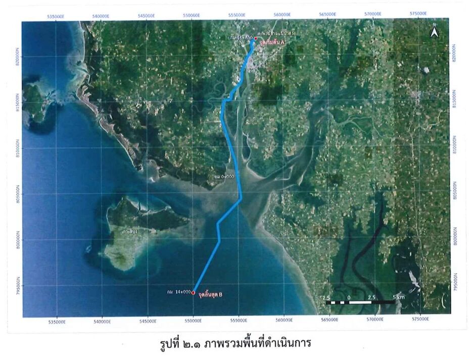
This stretch once held more than a thousand hectares of seagrass bed, sustaining Thailand’s largest Dugong population. But Nok says the construction company offered only one explanation for the catastrophic fallout: “At the outset of construction, we assumed the impact would be confined to the channel.” Four years after work was suspended – that is, in 2024 – seagrass finally began regrowing here. This patch beneath our feet is the first sign of its return.
According to a report by the US non-profit environmental outlet Mongabay, Thailand’s Dugong population stood at around 273 in 2022, with 90 per cent of them living in the Andaman Sea. Yet one-third of that population may already have vanished. In 2024, at least 40 per cent of Dugong deaths were attributed to starvation caused by the widespread collapse of seagrass.
A government scientist interviewed by Mongabay found that most of Trang’s Dugongs had either died or scattered along the coast, “scrambling to make a living.” Some had drifted as far north as Krabi, Phang Nga and Phuket, even as far as Myanmar. To the south, at least three dead Dugongs were found near Langkawi in Malaysia. The scientist estimated that fewer than ten Dugongs may remain in Trang Province today.
So, when we witnessed that recovering seagrass bed and the Dugongs’ feeding traces, we were, in a sense, seeing survivors pick themselves up after a catastrophe. But Nok worries that the displaced Dugongs face an uphill battle. They must adapt to unfamiliar environments and risk injury colliding with fishing boats that have never learned to watch out for them. “In Trang, fishers know how to adjust their speed to steer clear of the Dugongs,” he said. “But elsewhere, people simply don’t think about it.” “Here, we will protect the Dugongs,” he added. “Anywhere else, our hands are tied.”
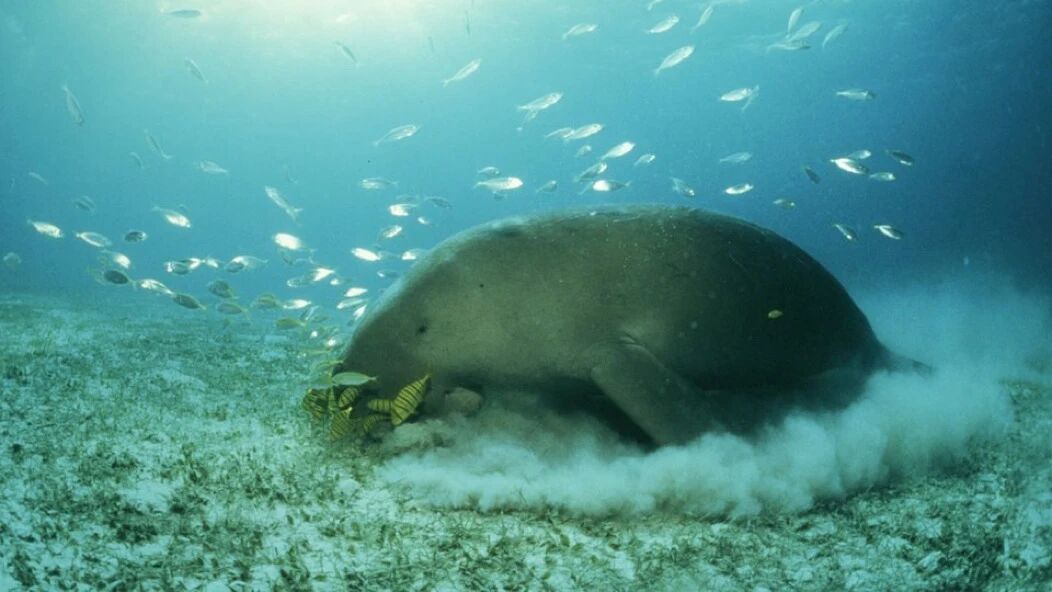
The distant waters a Dugong drifts into may offer no food at all. According to the aforementioned Mongabay report, there is almost no usable seagrass bed left around Phuket. Government officials have even tried supplementing migrating Dugongs’ diets with kale and cabbage – the sort of food typically reserved for rescued Dugongs in aquariums.
Fishers can march and weep for their ruined homes, but who speaks for the Dugongs, the seagrass, the coral? Only environmental NGOs like SAN can try.
Libong Island has another species of long-leaved seagrass – food for sea turtles. But Nok explained that this seagrass takes two years to mature enough to reproduce, and if sea turtles graze it down before then, it struggles to spread into a proper stand. “So protecting the sea turtles and protecting the seagrass pull in opposite directions,” he said. The team looked genuinely troubled, even though providing food for sea turtles is one of the very reasons they work to restore the seagrass.
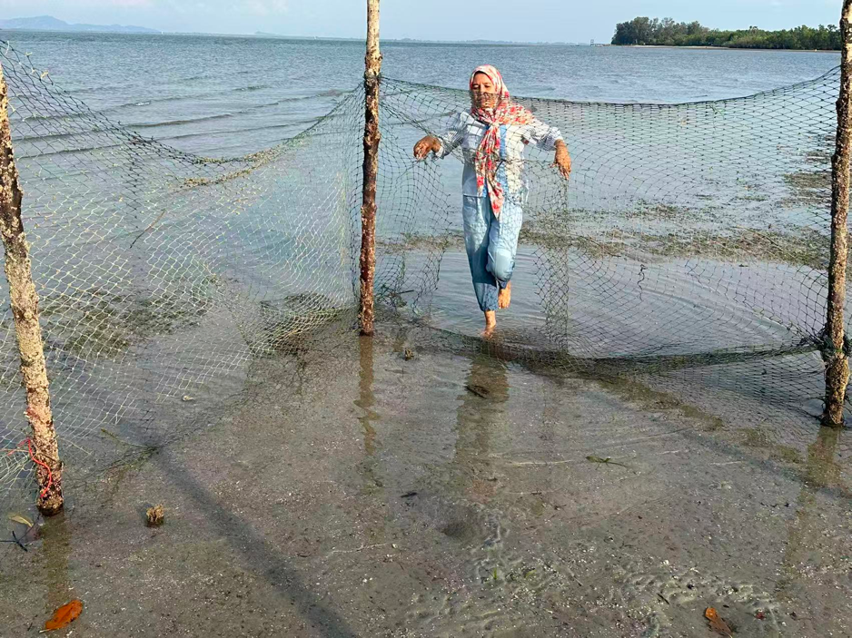
In a sort of trial-and-error approach, they used bamboo stakes and fishing net to fence off a few square metres of beach and planted long-leaved seagrass inside the enclosure. It has not worked well. When we visited, the plot was almost entirely bare, with only a handful of stray shoots poking up here and there.
III. Crab Bank
Since the 1990s, as global demand for crab meat grew, unsustainable fishing methods such as trawling pushed Thailand’s Blue Swimming Crab catch to a peak of 46,678 tonnes in 1998 – far beyond the maximum sustainable yield. To safeguard fishery resources, Thailand introduced a series of policies to restore stocks, and civil society began to act too. The Crab bank was one such initiative.
The Crab bank we visited sits within the community conservation centre, in a simple shed built of timber. On the floor stands a row of large blue plastic barrels; on the table are a few glass aquariums; and thick tangles of plastic tubing sprawl everywhere, pumping oxygen into the water. The village chief casually scooped up a female crab from one of the barrels – her underside was a glowing mass of bright orange eggs. Tens of thousands of eggs, held fast to the female’s abdomen by a sticky mucus. The orange colour means the eggs are still developing. The village chief explained that once the eggs turn grey, it signals that spawning is imminent and the crab must be released back into the sea within five days.
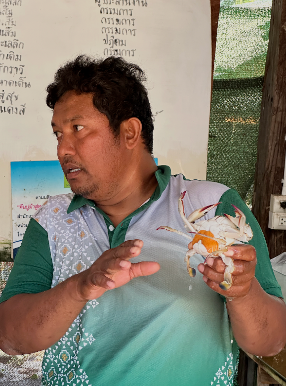
These eggs will hatch in the sea into planktonic larvae – hundreds of thousands, even millions, from a single brood. The village chief believes the Crab bank helps the population recover. He said that previously they could only catch Blue Swimming Crabs for six months of the year, but now they can catch them year-round, making it a vital source of livelihood.
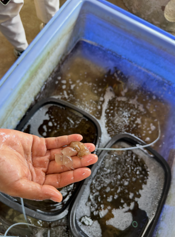
The fishers have developed a habit of not just keeping Blue Swimming Crabs, but also placing any other marine creatures in breeding season here for safekeeping. We also spotted squid eggs, resembling a string of translucent grapes. Someone had found them tangled in the net while hauling it in and brought them back.
According to Mongabay, the data do suggest that Blue Swimming Crab populations have increased since the Crab bank and “other measures” were introduced. In 2017, Thailand’s Department of Fisheries, WWF and several private-sector partners jointly launched a Fisheries Improvement Project, promoting measures such as Crab banks, seasonal bans on catching berried crabs, and restrictions on trawling and certain fishing gear (for example, crab pots with a mesh size under 6.4 centimetres).
But stock enhancement alone is not enough. Amonsak Sawusdee, a marine biologist who has studied Blue Swimming Crabs for decades, also stressed the importance of establishing proper regulations for fishing gear and enforcing them, as well as setting up protected areas for spawning and juvenile crabs.
In the very same waters, the engineering project that destroyed vast tracts of seagrass bed coexists with the fishers’ Sisyphean Crab bank – to an outside observer, a rather absurd tableau. And yet it is precisely the fishers’ own spontaneous actions, combined with collaboration from NGOs, that have stood up against destructive industrial projects and overfishing while safeguarding native species.
How can a conservation model rooted in local knowledge and co-governed by coastal communities become the norm rather than the exception? The LMMA offers one possibility – the “Community Protected Area” model, in which government and community manage the sea together.
IV. LMMA: Communities Manage the Sea
The LMMA emphasises that conservation and livelihoods must coexist, because only then will the community itself endure. How fishing communities navigate their own livelihood models will be the focus of the next field journal. In this one, we look first at how an arrangement involving multiple actors – government, NGOs and community associations – can actually take root.
First, a point of context: as in China, marine and coastal resources in Thailand (such as mangroves) are state assets, and the relevant administrative body is the Department of Marine and Coastal Resources (DMCR). Community Protected Areas are also managed by the DMCR. Land designated as marine national parks carries a higher level of protection and falls directly under the Department of National Parks, Wildlife and Plant Conservation.
In Satun Province we visited the renowned Mu Ko Phetra National Park, within which two Community Protected Areas have been carved out. A senior official from the local national park authority told us that the park had been established 42 years ago and had been managed on a closed-access basis all along. In biodiversity conservation, a “protected area” is a designated zone set aside for species conservation – national parks are a typical example – but in many places this has meant the exclusion of indigenous communities.
Yet the managers eventually came to see that this approach was not viable and that local people should be allowed to earn their livelihood from the national park – but only in a sustainable way.
While we spoke, we stood beneath a blue notice board put up the previous year by the sea. It is an official notice of Community Protected Area management rules, setting out the boundaries of the area, prohibited activities (such as the use of illegal fishing gear) and penalties. The entire mapped area in the centre of the sign falls within the national park; the yellow and orange zones marked within it correspond to the Community Protected Areas of two villages.
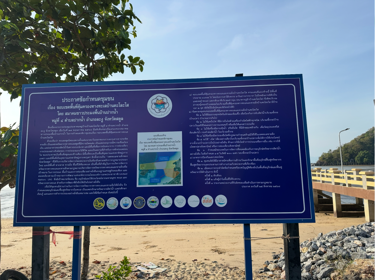
Fishing is strictly restricted across the entire national park; the only gear permitted is of the most traditional kind. But within the two Community Protected Areas marked in yellow and orange, fishers can undertake a wider range of harvesting and gathering activities, in return for certain obligations: species monitoring, patrols, and the construction of fish habitats. At first glance, these two Community Protected Areas look rather like snatching food from a tiger’s jaws, but correspondingly, fishers must demonstrate that while carrying out their fishing, they are also restoring the marine ecosystem.
And so we find ourselves in a fascinating situation: these Community Protected Areas, branded as LMMAs and administered by the DMCR, actually sit within the national park’s boundaries. The governing departments differ, and in terms of legal force, the National Park Act takes precedence over the Community Protected Area management framework. In other words, what has happened is that LMMA, as a mode of governance, has been embedded within the national park’s statutory framework. Reaching this stage genuinely relied on years of constructive engagement and mutual trust between various government departments, fishers’ associations and NGOs.
In practice, LMMAs have indeed taken shape through negotiation between communities and government. Only areas meeting certain criteria are eligible to apply as Community Protected Areas: the community must hold traditional or existing usage rights; there must be a clearly defined community organisation (such as the fishers’ associations we met on this trip); and the community must reach internal consensus and develop a set of management rules.
When it comes to “developing management rules”, the role of NGOs is often indispensable. Their work centres mainly on awareness-raising and capacity-building within the community – teaching fishers species monitoring, community mapping, meeting procedure, and legal literacy. Externally, they play more of an “intermediary” role, “translating” communities’ claims to rights into language that government and stakeholders can work with, particularly the formal legal register required for policy advocacy and legislative proposals.
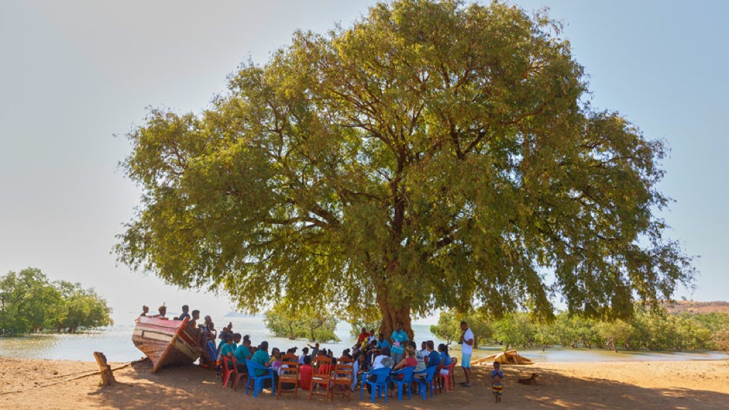
This bridging role was vividly reflected in the way our itinerary was arranged. Getting to meet the national park authority’s senior official and have a chat was actually courtesy of the Thai Sea Watch Association (Thai Sea Watch for short). And whether in Thai Sea Watch’s office, on a boat heading out to fish reserves at sea, or sitting on the ground in a village chatting freely with residents, the people who turned up came from all walks of life: community representatives, women’s representatives, local council members, government officials – often from several departments at once, the DMCR, the National Parks Department… Even when every sentence had to go through consecutive interpretation and the talks stretched over half a day, tiring in their own way, they all participated patiently throughout.
Fishers are expected to draft their own community regulations. In Satun, the fishers in several LMMAs working with Thai Sea Watch were also encouraged to name their respective protected areas: the act of “naming”, with its sense of ceremony, helped them feel a sense of community ownership.
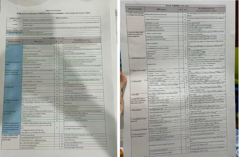
The multiple government departments involved in LMMA governance are also required to endorse the LMMA management rules. Tab, the head of Thai Sea Watch, showed us a memorandum of understanding signed by the community, the local government and the NGO. Two enormous sheets of paper were crammed with dense Thai script, every management detail negotiated clause by clause and confirmed by all parties. Provisions affecting the community alone covered nineteen categories – for example: no one may act alone; one must collaborate with partners, who can be government departments, NGOs, or even neighbours.
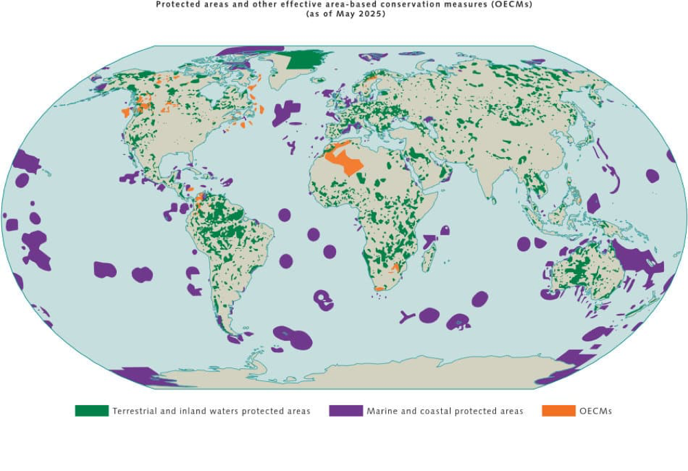
Language is a tool of thought, and coining concepts is a strategy NGOs commonly employ in policy advocacy. Take, for example, the concept of OECM – Other Effective Area-based Conservation Measures – which emerged to drive global conservation action. Many LMMAs can qualify as OECMs, but Tab says they prefer the LMMA concept.
OECMs refer to areas outside formal Protected areas where governance can sustainably achieve in situ biodiversity conservation outcomes – such as urban green spaces or nature-friendly farmland. In 2018, OECM became a formally defined reporting mechanism under the Convention on Biological Diversity; it must be reported by nations and is used to track conservation targets and progress at the global level.
Whether Protected areas or OECMs, all these concepts have been pushed onto the political agenda of global environmental governance by international bodies – in other words, a “top-down” process. Driven by international negotiations, OECM is becoming accepted and used as common currency among governments and international organisations. Many Community Protected Areas have the potential to be registered as OECMs – although they do not qualify for direct funding in the way protected areas do, the prestige of an OECM designation makes it easier to attract international cooperation, carbon credit trading schemes and other external support.
Yet NGOs and fishers prefer the more grassroots concept of LMMA – in other words, one that places greater emphasis on community self-management. Tab’s nonchalance towards OECM gave me a glimpse of an interesting shift: grassroots NGOs seem to have lost their appetite for the grand, haloed concepts embedded in international environmental governance frameworks, turning instead to approaches that affirm self-governance and deliver tangible benefits.
V. Rejecting Carbon Sink “Enclosure”
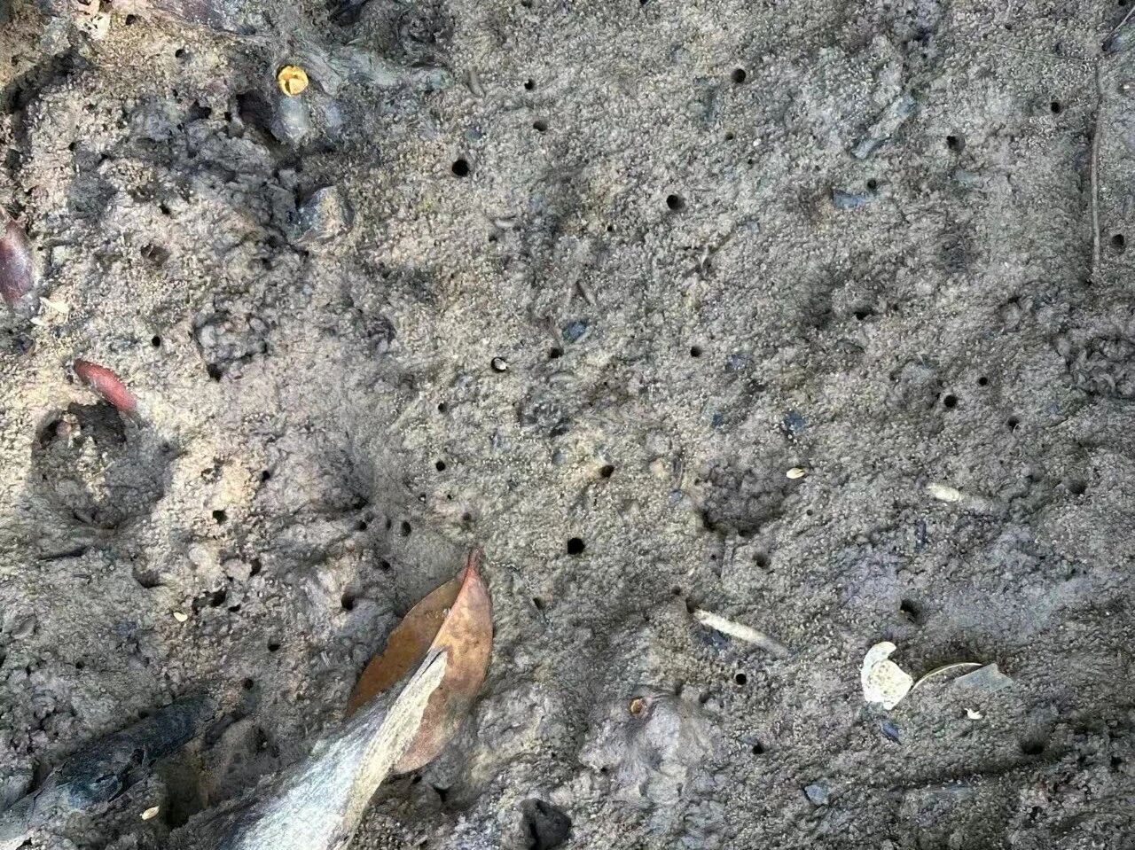
The reason: the mangroves here had been held by a company for twenty-one years under a concession to produce charcoal. During that period, any villager who needed timber had to obtain the company’s permission – which was practically impossible to get – so they could only cut trees in secret. Over those years, they found it increasingly hard to find food in the mangroves and their surroundings. They regard crabs and shellfish as indicator species for ecosystem health – not only have these two groups been in decline, but some marine species have even vanished altogether.
Villagers believe this is directly linked to the company’s logging in the mangroves. A telling example is the mud crab, a species that burrows into the mud to shelter. With no tree shade, the sun scorches the mud so fiercely that mud crabs simply cannot survive. In other words, without mangroves there is no living space for animals, and a beach that was once a vibrant paradise turns into a barren wasteland.
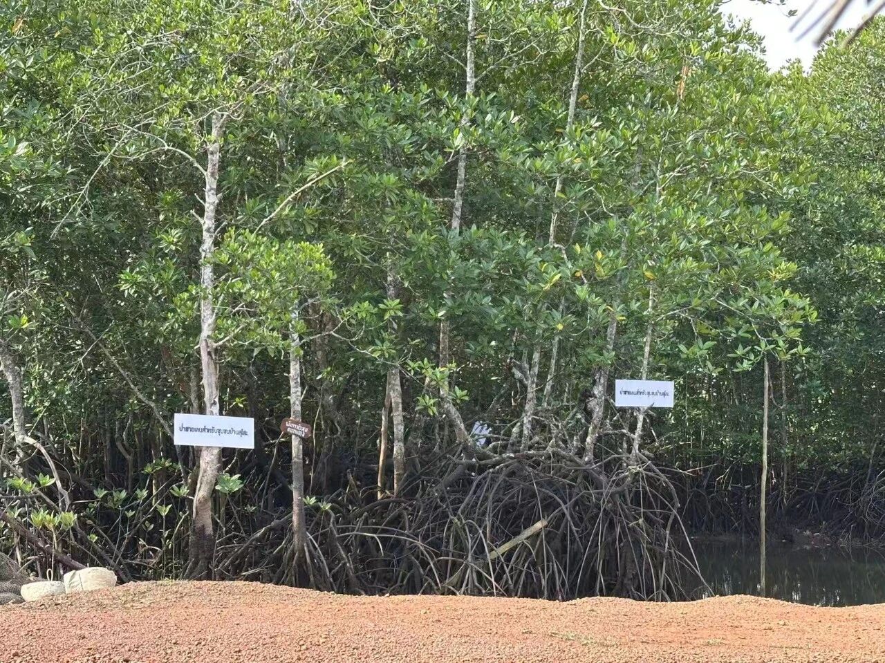
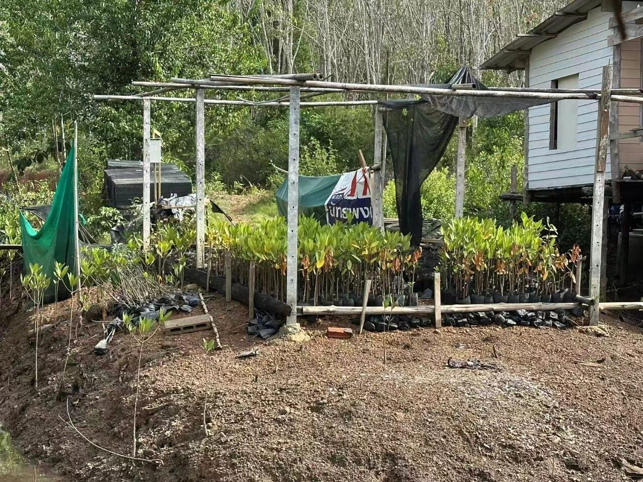
So after the concession expired, villagers who had come to understand the damage began planting trees on their own initiative. Five villages formed a mangrove conservation group and applied to the DMCR to establish a Community Protected Area.
The application was approved in 2024. They secured a Community forest – which means they have been granted ten-year management rights over the mangroves, providing legal backing for the community’s claim to resource-use rights.
In 2025, a report by Thailand’s Knowledge Foundation for Development found that, in the name of tackling the climate crisis, the Thai government has been aggressively promoting its Voluntary Emission Reduction Scheme, allowing companies to purchase carbon credits by funding mangrove restoration to offset their greenhouse gas emissions. Yet the scheme’s implementation on the ground has sparked serious inequities. In one existing project, for instance, profit-sharing sees the company take seventy per cent, the community a mere twenty per cent, and the DMCR ten per cent – yet neither the company nor the government has ever transparently explained to the community the basis for this split.
Moreover, the DMCR and companies often bypass the villagers at large, going directly to the village chief or selected representatives for signatures. Villagers have even been forced to sign agreements under pressure from government officials, without understanding the contract terms. This top-down, opaque process has also sown suspicion and division within the community.
Speaking to HaRDstories, Tab argued that mangrove carbon sink projects cannot truly address global warming. “The principle set by the United Nations is clear: whoever pollutes must bear the responsibility to put it right. But that has been twisted into a plan to hand us a carbon market,” he said. “Tackling global warming means cutting emissions – not using money to seize what was never theirs.”
Now, with a Community Protected Area in place, residents have firmer ground to stand on when saying no to enclosure projects like these.
Coming Up
This is the second of three field journals from Foodthink’s visits to small-scale fishing communities in southern Thailand. The first, Thirty Years Defending the Sea Together: No Solidarity, No Fish | Field Visit to Small-Scale Fishing Communities in Southern Thailand, describes how small-scale fishers in Satun Province joined forces to drive out commercial trawlers, and how fishers’ associations from different areas came together to form a national alliance, taking an active part in legislative and policy advocacy. To learn more about how conservation and development coexist in these local fishing communities, stay tuned for the third and final article.

Unless otherwise noted, all images in this article were taken by the author.
Editor: Pei Dan